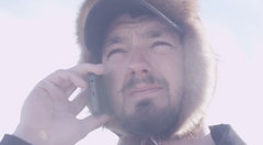
The team is on the coast now and things are going to be FAR different! The winds will blow, but what a sunset they will see tonight!!
From the Iditarod Description-
The actual distance on this leg is usually about 37 or 38 miles. The race follows the main snowmachine trail to Shaktoolik; it is normally well traveled and well marked. The first 25 miles cross a mix of woods, taiga, open areas, and exposed ridge tops; the last 12 miles are completely in the open on the barren coastline. This leg usually takes four to six hours, but can be much longer if the weather is bad. The trail leaves Unalakleet northbound and runs just in from the beach, turning inland after five miles to pass behind rocky 850-foot-high Blueberry Point. It comes almost back to the shore at the fishing camp of Egavik before climbing up the Blueberry Hills, reaching the thousand-foot summit at the 18-mile point. At the top the trail turns west and makes a three-mile drop back to the beach, then follows a slough and the dune line northwestward for the last 12 miles out to Shaktoolik.
Weather-
Koyuk, Alaska (Airport)
Updated: 8:16 PM AKDT on March 15, 2010
Clear 3 °F
Windchill: -15 °F
Humidity: 36%
Dew Point: -18 °F
Wind: 14 mph from the North
Wind Gust: 21 mph
Pressure: 30.18 in (Rising)
Visibility: 10.0 miles