UPDATE- Officially IN at 10:05pm with 13 Dogs.
He is 33rd into Ruby.
If he takes his layover, I expect him to leave between 6:30am -7:00am tomorrow.
Another night to sleep!!
UPDATE- Officially IN at 10:05pm with 13 Dogs.
He is 33rd into Ruby.
If he takes his layover, I expect him to leave between 6:30am -7:00am tomorrow.
Another night to sleep!!

5 miles to go and take a break! Pete is on a equal Run/Rest strategy so I anticipate he will take his 8 hours in Ruby like everyone else has and head towards Galena in the morning.
Pete has been on mining roads for the last 40 or so miles. This is really the last road he’ll see until he gets quite a bit closer to Nome.
Ruby is 497 trail miles from Nome and the finish.
How ’bout a bit of Ruby trivia: (Wikipedia)
History

Riverboats on the Yukon River at Ruby, Alaska during the town’s heyday
The town of Ruby was established in 1911 as the result of a gold rush. Gold was first discovered at the current townsite in 1906 on Ruby Creek. That discovery brought more prospectors to the area. In 1910 word leaked out about a gold strike on Long Creek, 30 miles south of Ruby, and a stampede was on. Discoveries on other nearby creeks followed and Ruby became the supply point for the mines.
At its peak the population was near 3000. By 1918 The town was in decline. Many of the men had left to fight in WWI and several of the towns business people and their families were lost in the sinking of the ship Sophia.
A fire in 1929 destroyed much of the business district and a flood in 1931 took out what was left of buildings on the river front.
After WWII the population of the community had left. Natives from the village of Kokrines moved in to take advantage of the abandoned homes. There are currently less than 200 people living in Ruby.
Noted people
- Emmitt Peters– Last rookie to win the Iditarod Trail Sled Dog Race.
The largest gold nugget ever found in Alaska(294.10 Troy Ounces)was found near Ruby, Alaska in 1998.
Pete is on the move again towards Ruby.
Weather Conditions at Ruby:
-4 °F
Clear
Windchill: -4 °F
Humidity: 57%
Dew Point: -15 °F
Wind: 3 mph from the NE
Wind Gust: 5.0 mph
Pressure: in (Rising)
Visibility: 10.0 miles


Ruby Alaska
I talked with Pete’s Mom, Janet, this morning and asked about the In and Out of Cripple and she said that Pete has a definite plan for the race. He may have gone through Cripple and THEN rested along the trail. GPS Tracker shows him stopped 10 miles or so up the trail from Cripple. Most musher have been taking long breaks in Cripple, so if he breaks on the trail instead of Cripple, we should expect him into Ruby fairly late this evening. Stay Tuned!
|
-6 °F
Clear
|
| Windchill: | -6 °F |
| Humidity: | 55% |
| Dew Point: | -18 °F |
| Wind: | Calm |
| Wind Gust: | 4.0 mph |
| Pressure: | in (Rising) |
| Visibility: | 10.0 miles |
| UV: | 2 out of 16 |
| Clouds: |
Clear –
(Above Ground Level)
|
Pete is in and out of Cripple.
IN- 6:40am OUT- 7:00am DOGS- 13
This stretch follows mining roads most of the way into Ruby.
Once Pete reaches Ruby, he’ll also reach the first checkpoint on the Yukon. If you were to split the race into quarters, the first part is from Willow to McGrath- Mountains and such, Then McGrath to Ruby- Tundra Trails, then Ruby to Kaltag- Yukon River, Kaltag/Unalakleet to Nome- The coast. Each section is a bit different. Pete and his dogs will be used to the river trail and the wind that is sure to accompany it.

GPS Tracker shows Pete in and stopped in Cripple. The Standings Page from 6:30 hasn’t shown this yet, but the Tracker appears to be working (When it has failed it has showed him farther back, not forward).
After such a long run, I am expecting him to rest in Cripple for a bit. Other mushers have been resting at this checkpoint for 5-6 hours before headed out for Ruby. Ruby is 65 miles up the trail from the checkpoint.
The speeds listed on the Standings Page from Iditarod cannot be accurate. I believe they are using the old mileages. On the Mileages listing, they show this:
Ophir to Cripple- 59
Cripple to Rubby- 112
But on the Checkpoint descriptions they say that the Cripple checkpoint was moved:
-From Iditarod–Important Note The Cripple checkpoint was moved for the 2000 race. It will be located approximately 45 miles farther toward Ruby, at the Poorman airstrip. This is the same location used by the Iron Dog snowmachine race for its checkpoint. This significantly changes the nature of this portion of the race. The distance from Ophir to Cripple is now about 105 miles instead of the previous 60, and the distance from the Cripple/Poorman checkpoint to Ruby will be about 65 miles, instead of the previous 112. The Trail Notes have been revised to reflect this change.
Yet if you look at Jeff King’s time, he made the run from Cripple to Ruby in 9.47 hrs at a speed of 11.45mph. Simple Math shows 112 miles. I am confused.
From the times I am seeing, I think that the Note above is correct, but the speeds are wrong. We’ll ask Pete when we see him:)
LOWER KOYUKUK AND MIDDLE YUKON VALLEYS-
INCLUDING...GALENA...NULATO...HUSLIA...KALTAG...RUBY...KOYUKUK
322 AM AKST FRI MAR 12 2010
.TODAY...MOSTLY SUNNY. PATCHY FOG IN THE MORNING.
HIGHS ZERO TO 10 BELOW. LIGHT WINDS.

Current Ruby Weather
|
-19 °F
Light Snow
|
| Windchill: | -19 °F |
| Humidity: | 74% |
| Dew Point: | -25 °F |
| Wind: | 1 mph from the SW |
| Wind Gust: | 5.0 mph |
| Pressure: | in (Rising) |
| Visibility: | 9.0 miles |
 Melanie Gould of Talkeetna pulls into the halfway checkpoint at Cripple IDITAROD 2002
This night will be brutal for both dog and man. Either Pete is stopped, or the darn GPS tracker is offline on his sled (Again). Leading teams have been averaging about 10 hours for this leg. The gal that left Ophir right after Pete, Judy Currier, is about 15 miles from Cripple, so I would expect Pete to be close to her. The next leg this evening, after a break at the Cripple Checkpoint is 65 miles into Ruby. Cripple marks the Halfway point in the race.
From the Iditarod Trail Description:
This is now the longest leg of the entire race on either the northern or southern routes. The new distance is approximately 105 miles for the 2000 race. It will probably not run less than the posted mileage and will seem to take forever. It will now be necessary for most teams to camp for several hours along this leg. The trail generally runs along the Innoko River, crossing it three times. It then runs northeast away from the river, crosses the North Fork of the Innoko, and then runs along ridges on the east side of Poorman Creek. The terrain is mostly wooded with some open stretches in the river valleys. Expect 12 to 18 hours for this run. The trail has some rolling hills in the section between the North Fork of the Innoko and the Poorman airstrip.
LOWER KOYUKUK AND MIDDLE YUKON VALLEYS
INCLUDING…GALENA…NULATO…HUSLIA…KALTAG…RUBY…KOYUKUK
843 PM AKST THU MAR 11 2010
.TONIGHT…PARTLY CLOUDY. PATCHY FOG. LOWS 15 TO 30 BELOW. LIGHT
WINDS.
.FRIDAY…PARTLY CLOUDY. HIGHS ZERO TO 10 BELOW. LIGHT WINDS.


Pete’s Official Ophir Times:
IN- 2:20pm OUT- 2:35pm DOGS- 13 (11.11mph!!)


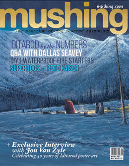 Check out the Kaiser Super Dogs in Mushing Magazine!