Good evening Race Fans!!
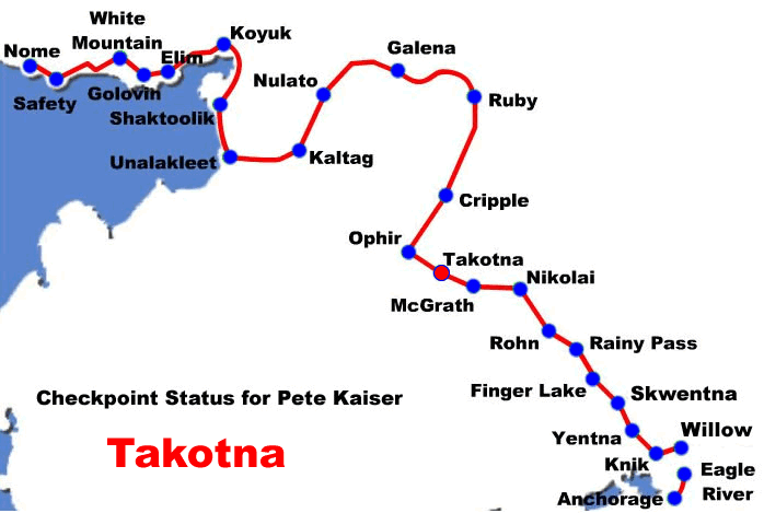
We had the whole day off today as Pete and the Team took their 24 hour mandatory layover. Takotna was again the site for this year’s break. It’s always tough to leave the hospitality of the community, but there is a race to run and it’s time to head off for Nome!!
The trail ahead will take them through a one lane hard packed trail, as Richie describes it, to the checkpoint of Ophir, 23 miles down the trail. After Ophir it’s a long 73 miles to the Cripple Creek checkpoint and then another 70 mile run into the Yukon village of Ruby.
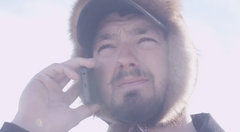
As Richie described it in tonight’s Kaiser Racing Radio, there’s a nice cabin along the way that, if it works out, may be a place for Pete and the Team to take a break tomorrow morning. It’s a long 166 mile run up to the Yukon so that will be much of tomorrow’s news. Weather is still good, but it looks like we are in for a cooling trend as weather reports show below.
See Ya in the morning! Go Team Kaiser!!
Weather tonight in Takotna:
Tonight: Mostly cloudy, with a low around 7. East wind around 5 mph.
Tomorrow’s weather for Ruby:
Thursday: Isolated snow showers before 9am. Mostly cloudy, with a high near 17. Northeast wind around 5 mph becoming calm in the morning. Chance of precipitation is 20%.
Thursday Night: Mostly cloudy, with a low around -3. Calm wind becoming north around 5 mph.
The weather challenge looming is the following weather statement calling for really cold temperatures coming to Teams by Friday:
…Cold Temperatures And Wind Chills Beginning Friday Night…
A deep arctic trough will move south over the Western Interior and West Coast and bring well below normal temperatures beginning Friday night. High pressure over the Chukchi Sea will bring strong north winds starting Friday night as well. Low temperatures by Saturday morning will be in the teens and 20s below zero and remain that way through Wednesday morning. Highs will range from near zero to 10 below. North winds of 10 to 30 mph with higher gusts will bring wind chills as low as the 40s to near 50 below zero.
West Coast and Western Interior…
Light snow continues south of the Seward Peninsula this afternoon, with heavy snow falling near Galena. This is associated with an upper level low over the YK Delta and will diminish overnight as that feature weakens. Skies begin to clear from north to south tonight as high pressure drifts south over the Chukchi Sea, with mostly clear skies expected over the area by Friday afternoon. Above normal temperatures today will plummet to much below normal by Friday. NE winds 10 to 30 mph and wind chills approaching -50 F are possible Saturday-Wednesday along the coast from the Seward Peninsula north.