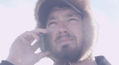
This is going to be an interesting night. Pete is headed to Rohn through the Dalzell Gorge. This treacherous trail has claimed a good many sleds and mushers and tonight there is little moon on the trail. He’ll be looking for the “Watch Your Ass” sign in the dark!
Rohn Weather Forecast:
.TONIGHT...CLEAR. LOWS 5 TO 15 BELOW. NORTHEAST WINDS 15 MPH.

On leaving Puntilla Lake the trail climbs immediately up out of the treeline dive down into one ravine very quickly and make a steep climb back up onto the tundra. From here to the mouth of Rainy Pass itself you’ll be running westward up a low ridge in the middle of the two-mile- wide valley. The view can be spectacular, but the trail is often blown in or just not visible and the snow is never very deep.
Out in the open expanse you’ll be looking for Iditarod trail stakes or, more importantly, six-foot-high wooden tripods spaced every few hundred yards. If the wind is blowing, you can be in a ground blizzard that can obscure the ground but may leave you perfect visibility from the back of the sled. You may not be able to see your dogs part of the time, even though you may see the mountains and the trail tripods with no trouble.
After ten miles you’ll leave the open main valley (which is properly called Ptarmigan Pass) and work toward a smaller valley opening to the right. This is the actual entrance to Rainy Pass cross the upper reaches of Happy River as you approach the side of the valley; there is often some minor overflow here.
Then you will begin to work northwest and north up the narrow Pass Creek valley leading to Rainy Pass, weaving across the frozen creek and in and out of clumps of willow bushes, steadily climbing. The only trail markers here are regular trail stakes. Watch for some steep rocky sidehill pitches that may not have much snow cover. There may be a few caribou on the sides of the valley; if the dogs notice them, you’ll go a little faster. When you reach a small alpine lake (Rainy Pass Lake) you’ll be a mile and a half from the summit. From the lake you’ll start a steep climb up to the summit, which is the highest point on the trail at 3,160 feet above sea level.
From the top it’s sharply downhill into the Pass Fork Valley on a long snowfield. Shortly after entering the timberline the trail will become narrow and twisting, running mainly along the creek, sometimes in narrow rocky ravines. Keep your speed down as much as feasible. There are some sharp turns and rocky patches that can surprise you. Watch for holes in the ice on the creek. After a couple of hard-fought miles the trail will open up a bit, but you’ll still be going in and out of willow bushes. At one point the trail will make a sharp diversion uphill and run along the high right bank of the creek before dropping back down. You’re probably going to spill the sled more than once on the stretch down Pass Fork, so hold on tight. This part of the trail is often in pretty bad shape, with pits and ruts and bumps.
Five miles after the summit you’ll come into the wooded valley of Dalzell Creek for a couple of miles of fairly easy running. Then you’ll swing across to the south side of the valley and make a sharp climb up to a forested shelf that runs along the valley side. The trail gets very narrow and winding with big trees on either side. You can easily see that the terrain is beginning to drop off sharply on your right.
After half a mile you’ll see a “Watch Your Ass” sign; immediately beyond is a steep 200-foot hill down into Dalzell Gorge. Depending on conditions, the Gorge can be nothing more than a very scenic exercise in sled driving, or it can be your worst nightmare come true. The worst-case scenario is minimal snow and lots of glare ice and open water. Hopefully you’ll have some warning if it’s really bad.
Once you’re down into the canyon, the trail will start jumping from side to side, crossing the creek (which always has open, running water) on sometimes-narrow ice and snow bridges, some of which may be collapsed. Even under good conditions, keep up enough speed to cross these bridges cleanly—if your dogs cut you across them or slow down at the wrong time you can find yourself in big trouble quickly, sliding down ice ledges into the water. (The water isn’t much more than a foot or two deep in most places, but it’s usually at the bottom of a nightmare of sloping ice.) At some points the canyon is barely wide enough for the trail and the creek. There are also lots of very big trees down in the gorge; the trail wraps tightly around a few of them.
The Gorge is only about two miles long (it seems like twenty) and then you’re suddenly out of it and onto the Tatina River. From the end of the Gorge it’s only five miles down the river to the checkpoint at Rohn Roadhouse. There is always some minor overflow (and sometimes not-so-minor overflow) and shallow open water along the river on the way to Rohn. The river surface can be very icy and slippery and there may be some rough ice. Just keep the dogs moving come up off the river ice onto the left bank and into the trees about a mile before the checkpoint. The trail will shortly turn down the right side of the runway; the checkpoint cabin is back in the trees at the far (south) end of the runway. Rohn is a good place to get some quality rest for you and your dogs. The checkpoint area is sheltered from the wind in big spruce trees.
Water is available a quarter mile away after climbing down a 25-foot bank to the South Fork of the Kuskokwim; most mushers just melt snow. The checkpoint cabin dates back to the 1930s; the old roadhouse vanished long ago. It is usually very crowded but you can find a place to curl up on the floor or on one of the bunks. Plan to leave Rohn with at least two or three hours of good daylight—you’ll need it for the next 20 miles of bad road down to Farewell Lakes.
Historical Note: In a few of the early years, the Iditarod didn’t use Rainy Pass. Instead, the trail made a long, 70-mile run past the mouth of Rainy Pass and south down Ptarmigan Pass to Hells Gate, a dramatic but reasonably wide and level-floored canyon through the spine of the Alaska Range cut by the South Fork of the Kuskokwim River. The trail then followed the river north back to Rohn. This route is still an option if Rainy Pass is unusable for some reason. The Iron Dog snowmachine race from Anchorage to Nome two weeks before the Iditarod always follows the Iditarod northern route, and tries to use the Hells Gate detour rather than risk the run down the Dalzell Gorge.
Dog teams can use trails that high-speed snowmachines cannot, and can even use some trails with very steep hills or drops or narrow side clearances that no snowmachine can traverse. Of course, Iditarod teams must follow the trailbreakers, who use powerful long-track snowmachines to set the trail, so the real dogs don’t get much chance to thumb their noses at the iron dogs on the race.